
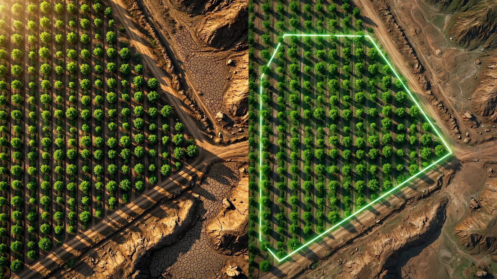
Tree Planting Verification in India: Use Satellite Maps Without Falling for Greenwashing
-
by
 TBH Editorial
 - No Comments on Tree Planting Verification in India: Use Satellite Maps Without Falling for Greenwashing
A plantation photo can show 500 smiling people, 5,000 saplings, and one hard truth hidden outside the frame: the site may have been bare long before the next monsoon.
That is why tree planting verification matters. A certificate, planting-day reel, or group photograph doesn’t establish the planting location, maintenance history, or survival outcome. If you fund a project, promote one through your company, or buy a product linked to a tree pledge, you deserve evidence beyond the launch-day story.
Satellite maps are evidence, not a complete verdict. Used properly, they can expose vague claims fast, but they can’t prove individual sapling survival, species identity, or the quality of care.
Key Takeaways
- Satellite imagery can verify a planting site’s location, prior land use, and changes in vegetation cover, but it cannot prove individual sapling survival, species identity, or care quality.
- A credible tree planting claim should include precise coordinates or polygons, planting dates, species and nursery records, dated before-and-after imagery, land-management details, and a long-term maintenance plan.
- Compare imagery across dry and wet seasons and over several years to distinguish lasting vegetation from seasonal crops, grass, weeds, or natural regeneration.
- Ground verification and community monitoring are essential for documenting survival, grazing, fire, flooding, irrigation failures, replacement planting, and other conditions satellites cannot see.
- Certificates, blockchain records, APIs, and satellite platforms can improve traceability, but they do not replace independent review, transparent loss reporting, or safeguards against double counting.
What satellite maps can prove, and what they cannot
Satellite imagery is not a survival certificate. In remote sensing, a sensor records visible land cover from above on a particular date. Cloud, haze, season, and image resolution can affect what it records.
That still makes it powerful. It can show whether a claimed planting site exists, whether it was already forested, whether it was converted from another land use, and whether vegetation cover improves over several seasons.
A green pixel is not a living sapling
India’s national forest mapping has limits that matter. In the India State of Forest Report 2023, the Forest Survey of India maps forest cover at a 1:50,000 scale, with a one-hectare minimum mappable area for this product. That is useful for broad change, but a small village plot, roadside row, or scattered urban plantation can disappear inside one pixel.
The Forest Survey of India’s overview of satellite-based forest assessments helps put this in context. National forest-cover data answers, “What changed across a district or state?” It does not answer, “Did 842 named saplings survive beside this school?”
A provider claiming exact tree numbers must show field evidence too.
An image can confirm land-cover change. It cannot identify a species, count every tree, or prove who planted it.
Timing can make a weak project look healthy
A single lush image after the monsoon proves almost nothing. Seasonal grass, crops, weeds, and naturally regenerating shrubs can all look green from above.
Check imagery from three points:
- Before planting, to see the original site condition.
- Soon after planting, to confirm the location and any visible land preparation.
- At least one or two growing seasons later, to see whether cover persists.
If a project only shares one undated aerial image, it has given you a mood board, not evidence.
Start with the claim, not the map
Most bad verification begins with a vague promise. “We planted trees in Maharashtra” is not a claim you can test. “The project says it planted 3,200 native saplings across 4.6 hectares in village X, at latitude Y and longitude Z, during July 2025” is specific enough to investigate.
Ask for the basic record before opening any mapping platform. Coordinates, polygons, land ownership, and dates form the geospatial data that makes a claim testable.
The evidence a credible project should provide
A serious tree planting partner can provide the following without acting offended:
- GPS coordinates or clearly marked polygons for all planting sites.
- Planting dates, area size, species list, sapling count, and the tree nurseries that supplied them.
- Before-and-after photographs with location data and dates.
- A survival-monitoring schedule, not only an initial planting report.
- Details of who owns or manages the land.
- A clear maintenance plan, including community monitoring of grazing, fire, water access, invasive-species control, and replacement planting.
You can also request batch or dispatch records from the tree nurseries. They support the planting record, but they don’t prove field survival.
Documents and maps should lead to field verification, through a site visit or a credible local inspection.
This is where climate literacy gets practical. It is not about memorising carbon terms. It is knowing which missing detail turns a beautiful claim into an uncheckable one.
For mangroves, the questions get even sharper. A planted mangrove can’t survive where tidal water no longer reaches the site. Read why mangrove planting depends on tidal flow before treating planting counts as restoration. A satellite view can show land and water patterns, but it can’t establish mangrove survival without field evidence.
Tree planting verification in India with satellite maps
You do not need to be a remote-sensing specialist to make an initial check. For sustainable reforestation, you do need patience, a precise location, time-series images, and field evidence when the story and map do not match.
Start with Indian public data, then compare it with independent satellite imagery.
Use Bhuvan and Forest Survey of India for the wider picture
ISRO’s Bhuvan platform is India’s national geoportal. Its forest and environment resources direct users towards map layers for land use, forest cover, and environmental planning. The ISRO forest and environment portal is a reliable place to understand what official geospatial data can show.
Use it to ask basic questions:
- Is the claimed site near an existing forest, farmland, wetland, settlement, mine, or road?
- Does the surrounding area show a pattern of tree cover or heavy fragmentation?
- Is the project claiming new planting on land that was already visibly wooded?
Then compare the project’s story with Forest Survey of India reporting, especially the relevant dated assessment. For reforestation projects claiming major landscape-scale restoration, district-level change is useful context, not proof of one provider’s work.
Check time-series images through Sentinel and Landsat
For site-level checking, use images from multiple dates. Sentinel-2 can offer finer spatial detail in some optical bands. Copernicus Sentinel-2 documentation lists four 10 metre bands, six 20 metre bands, and three 60 metre bands. Landsat documentation from NASA and USGS describes generally 30 metre multispectral bands and a longer historical record.
Google Earth Engine provides access to public satellite datasets and analysis tools, including forest and vegetation layers, through its Earth Engine data catalog. Treat it as an analysis platform, not an independent audit or proof of impact.
Look at the same boundaries across dry and wet seasons. Compare the year before planting with the year after. Zoom out as well. A bright green patch in a large agricultural area may be a crop cycle, not a growing forest.
Cloud cover is a real problem in India, especially during monsoon months. Do not assume a blank image means a failed project. It may only mean clouds blocked the view. But a project should be able to supply ground records for those months.
Read the land, not only the colour
Trees aren’t interchangeable green units. A dense-looking canopy can still be poor restoration if it replaces grassland, drains a wetland, or relies on one fast-growing species. More canopy isn’t automatically better for habitat or restoration.
This is where corporate tree planting can fail the ecological test and drift into greenwashing. Projects may count trunks without asking what the site needed.
Watch for land-use change that harms biodiversity
Before celebrating an increase in canopy, check what was there first. Native grasslands, scrub ecosystems, and wetlands aren’t failed forests because they don’t look like forests on a map.
That mistake can damage birds, insects, reptiles, grazing livelihoods, and water systems. Urban biodiversity faces the same problem. A row of ornamental trees along a road may look green, yet offer little shade, food, nesting space, or water access for local species.
Ask which documented restoration standards or framework guide the project, such as relevant MoEFCC guidance, IUCN material, or peer-reviewed research. Check whether tree nurseries supplied healthy stock with the right ecological fit for local soil, rainfall, elevation, tidal conditions, and ecology. The project should also use native species suited to those conditions.
A monoculture plantation can produce a clean satellite signature while delivering far less habitat value than mixed regeneration. Satellite or map-based greenness can’t identify species or establish habitat quality on its own.
Look for patterns of stress and abandonment
Satellite imagery can reveal screening clues, especially after two or three years:
- Bare patches returning inside a claimed plantation block.
- A sudden green flush followed by repeated browning.
- New roads, construction, mining, or farming cutting into the site.
- A narrow plantation strip with no buffer from grazing or fire.
- Dense vegetation appearing only during crop-growing months.
None of these clues is proof that a project has failed. They are reasons to ask harder questions and request an inspection record.
The point isn’t to catch every project in a lie. It’s to stop treating vague reassurance as proof.
Ground truth is where accountability lives
Satellite maps see canopy. Communities see goats entering a plot, a broken water line, a sapling nursery left unpaid, or a creek blocked by silt.
That local knowledge is not an optional extra. Community monitoring records goats entering a plot, fire, flooding, broken irrigation, and illegal cutting through dated, geo-tagged photos and field notes. Field verification can support or challenge satellite observations, but metadata and photographs still need reasonable validation.
Ask who returns after planting day
A project should name the local people responsible for monitoring, and pay them fairly for that work. They can document survival, damage, replacement planting, fire events, flooding, and illegal cutting with geo-tagged photos and short field reports. Records should link each planting batch to the tree nurseries that supplied it.
That creates a stronger chain of evidence than a drone video taken once for donors. A monitoring platform can connect coordinates, planting batches, repeat observations, mortality reasons, and replacement records.
I trust restoration work more when it connects ecological repair with human stability. Mission S.E.E.D. mangrove restoration links native mangrove planting with support for children and local education. That is closer to systemic change than dropping saplings into a stressed landscape and leaving.
Measure tree survival rates, not just distribution
Ask for tree survival rates at 6, 12, 24, and 36 months. These are recommended monitoring intervals, not a universal statutory standard. Ask what the denominator includes: all planted trees, a sampled block, or only live trees in accessible areas. Request dispatch, hardening, and quality records from the tree nurseries, but don’t treat healthy stock as proof of field survival.
Also ask whether the method accounts for seasonality, drought, flood, grazing, and replacement planting. Ask what happens when trees die. Honest projects report loss. They explain why it happened, whether drought, flood, grazing, poor species choice, or land conflict caused it. Then they show what changed.
A perfect survival figure should make you more careful, not less.
Check the provider’s systems and incentives
Businesses often attach a tree pledge to a checkout page, linked to a product, delivery, subscription, or loyalty reward. A tree-planting API can pass project or customer data between systems, but it can’t establish planting, survival, or ecological quality. That can support restoration, but it can also turn living ecosystems into greenwashing claims.
Sustainable business models need measurement that survives scrutiny.
Certificates should prevent double counting
A digital certificate can help track a contribution. It should include a unique project ID, coordinates or polygon, planting date, partner, quantity, and status. It should also identify any tree nurseries involved, the monitoring method, and ownership or management information.
Blockchain certificates can make entries easier to trace, but an immutable record doesn’t prove the original field data was truthful.
The veritree platform is one example of a digital monitoring or traceability provider, not a substitute for independent review. Check its current methodology, data fields, public project evidence, and independent validation. A map or certificate alone doesn’t prove survival.
Technology can’t repair a weak first entry.
Ask whether the provider prevents double counting. The same trees shouldn’t be sold to several customers or counted toward a company’s ESG targets. They also shouldn’t be claimed again for carbon accounting without transparent rules.
These are separate claims, and each needs a clear accounting rule.
The Google Earth Engine platform can support satellite time-series analysis, but it can’t audit a company’s financial incentives, land agreements, or field records.
Demand an independent view
Third-party audits matter because providers shouldn’t be the only judge of their own work. Look for named auditors, their independence, sampling design, site visits, and a published methodology. Useful reports should disclose exclusions, failures, corrective actions, and the basis for impact reporting.
A good provider also separates these ideas:
| Claim | Evidence needed |
|---|---|
| Trees were planted | Coordinates or polygons, field logs, dated photos |
| Trees survived | Repeat monitoring and survival data |
| Habitat improved | Species, soil, water, and biodiversity evidence |
| Carbon was removed through carbon sequestration | A conservative, dated carbon method, permanence assumptions, leakage treatment, and long-term protection |
A tree can be planted without becoming a carbon credit or carbon offset. That distinction protects people from inflated climate claims.
Make your money and attention count
Tree planting is one part of climate and ecological action, but its environmental impact doesn’t replace cutting emissions, protecting existing forests, reducing waste, or building a circular economy that uses fewer raw materials. Some plant-based choices can lower pressure on land, but they don’t excuse companies from proving the forests they advertise.
The better question is never, “Did they plant a tree?” A claim without proof can be greenwashing, so ask, “What changed on this piece of land, who protected it, and can anyone verify it next year?”
For readers who want to see current work rather than rely on distant promises, Explore Our Active Missions to learn about ongoing community projects tied to climate literacy and local ecological work.
Frequently Asked Questions
Can satellite imagery prove that trees were planted?
Satellite imagery can show whether a claimed site exists, what land cover was present before planting, and whether vegetation changes over time. It cannot reliably identify individual saplings, confirm species, or prove that a provider planted the trees it claims.
What information should a credible tree planting project provide?
Ask for coordinates or site polygons, planting dates, area and species details, nursery records, dated photographs, land-management information, and a monitoring schedule. The project should also explain how it measures survival and responds when trees die.
How long should tree survival be monitored?
Request survival data at 6, 12, 24, and 36 months, while recognising that these are recommended monitoring intervals rather than a universal statutory standard. The project should explain its denominator and account for seasonality, drought, flooding, grazing, and replacement planting.
Can a tree planting certificate prove environmental impact?
A certificate can help identify a contribution or track a project, but it does not by itself prove planting, survival, habitat improvement, or carbon removal. Those claims require different evidence, including field records, repeat monitoring, ecological data, and transparent accounting.
Why is community monitoring important?
Local monitors can document conditions that satellites cannot see, such as grazing, fire, broken irrigation, flooding, illegal cutting, and conflicts over land. Their dated, geo-tagged records strengthen satellite findings and help show what happened after planting day.
Final thoughts
A satellite map is not a magic truth machine. It is a window, and you still need to look through it with care.
The strongest evidence combines coordinates, dated before-and-after imagery, local monitoring, survival data, independent review, and transparent loss reporting. Proof is not a polished certificate. Proof is a record that holds up after the cameras leave.
Bring that same everyday mindfulness to every green claim you fund, share, or wear.