
India’s Elephant Corridors Need Protection Beyond Forests
 TBH Editorial
An elephant can leave a protected forest and enter danger soon after, without leaving its traditional route.
If you care about the elephant corridors India depends on, the gap between protected habitat and safe movement matters to elephant conservation. We can defend a reserve on paper while allowing roads, fences and construction to close its exits.
The people living beside those exits then carry the consequences: damaged crops, interrupted journeys and fear after sunset. Protection has to follow the elephant’s route, including the land outside forest boundaries.
Key takeaways
- India identified 150 elephant corridors across 15 states in its 2023 assessment, but identification doesn’t guarantee legal protection.
- Declining use, impaired routes and missing monitoring data need different responses.
- Corridor protection must cover surrounding land, infrastructure operations and community livelihoods, with named responsibilities and funded repairs.
What India’s 150 elephant corridors tell us
The Ministry of Environment, Forest and Climate Change’s Elephant Corridors of India 2023 report documented 150 ground-validated corridors across 15 elephant-range states. Project Elephant conducted the assessment with technical support from the Wildlife Institute of India.
West Bengal had the highest state count: 26 corridors. The national network includes routes in the Western Ghats, North-East, northern foothills and Central India.
But a corridor count tells us little about whether animals can still pass safely.
The report recorded several different conditions:
| Reported condition | Number of corridors |
|---|---|
| Elephant use increased | 59 |
| Elephant use remained stable | 29 |
| Elephant use decreased | 29 |
| Current-use information unavailable | 18 |
| Impaired corridors requiring restoration | 15 |
These categories demand different investigations. Declining use might reflect obstruction or changing movement. Missing information requires monitoring. Impaired routes require restoration planning.
Even increased use needs interpretation. Elephants may concentrate along a remaining route after another becomes inaccessible. More sightings alone don’t establish healthier connectivity.
The ministry treats 150 as a minimum identified inventory, open to revision. Comparing it with the 88 corridors in the earlier Gajah report doesn’t measure habitat recovery.
Better mapping can reveal more routes while conditions on the ground deteriorate. We should resist turning an inventory into a conservation victory.
Why elephant corridors in India extend beyond forests

Movement connects food, water and breeding populations
Asian elephants move across large areas, often beyond Protected areas, to find food, water and seasonal refuge within their home range. A reserve boundary can’t contain those needs.
Corridors connect habitat patches that habitat loss and habitat fragmentation would otherwise isolate. They allow movement between populations and support genetic exchange over generations. Block those connections, and smaller populations face fewer opportunities to breed across groups.
Routes may cross scrub, village commons, plantations or seasonal water bodies. Roads, farms and a growing human population can add pressure on these links. Land without dense forest can still connect two indispensable habitats. Calling it vacant doesn’t remove its ecological function.
A blocked route transfers risk to people
Habitat fragmentation changes where elephants encounter settlements. A fence across a familiar passage can redirect movement toward crops, houses or traffic. That can increase human-elephant conflict and expose nearby residents to risk.
Keeping routes usable can reduce some dangerous encounters. It won’t eliminate human-elephant conflict, and promising that would mislead families already living with it.
Around Deepor Beel near Guwahati, wetland access, forest connections and railway infrastructure belong in the same conservation discussion. Protecting one habitat while neglecting the journey between habitats leaves the system incomplete.
The question is practical: can elephants reach what they need without being pushed through places where people are most exposed?
Give corridor maps consequences in land-use decisions
Protect the entire route, including its approaches
A mapped corridor needs boundaries that local planning authorities can use. Protection must extend to entry points, connecting habitat and seasonal water access.
Each state forest department should work with revenue departments, local governments and infrastructure agencies. Otherwise, one authority can recognise a route while another approves development across it.
The assessment’s proposed integration of corridors into state working plans and management plans is a starting point. It doesn’t mean every identified corridor already has secured land or a uniform legal designation.
Environmental assessments should consider the combined pressure on ecological conservation from a road, railway, transmission line and industrial estate. Separate approvals can miss these cumulative impacts.
Our guide to environmental assessment red flags helps readers question missing seasonal surveys and narrow project boundaries.
Make uncertainty visible before approving damage
The report notes that completed corridor submissions weren’t received from Uttarakhand and Karnataka. Earlier Gajah lists informed validation there. That caveat matters when comparing states.
Parliament’s answer on elephant corridors also distinguishes declining use from impairment. Neither category should disappear inside a reassuring national total.
A shared monitoring system should record survey dates, seasonal coverage, barriers and restoration status. Forest departments can combine field observations with research institutions’ camera-trap and habitat analyses.
Sensitive animal locations need restricted access. Public accountability requires condition reports and decisions, not live coordinates that could expose elephants to harm.
Make roads and railways answer for safe passage

Avoid the route first, then design around animal behaviour
Early road and railway planning should consider avoidance or realignment before treating a crossing structure as the default solution.
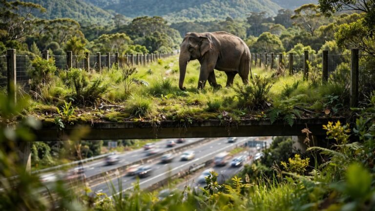
Where a road or railway track intersects a mapped route, underpasses and overpasses need suitable clearance, usable approaches and reliable drainage. Elephant-sized engineering won’t help if parked vehicles or fencing block the entrance.
Guiding fences must direct animals toward safe passage without creating another barrier across essential movement routes. Noise, headlights and human activity at entrances also need investigation.
Railway mitigation should combine risk-based speed restrictions, communication with forest staff and detection systems where suitable.
AI-assisted or thermal detection deserves testing for missed detections and response times. An alert prevents nothing unless someone receives it early enough to act.
Measure protection after construction
A camera-trap photograph proves an animal used a passage at that moment. It doesn’t show fewer collisions or reliable movement across seasons.
Monitoring should record completed crossings, hesitation and retreat. Collision surveys need consistent methods and information about changing traffic volumes.
Our examination of safer highway wildlife crossings explains why approach protection and maintenance matter alongside construction.
A falling collision count can hide a blocked corridor if animals have stopped crossing. Safety and connectivity need separate measurements.
Railways, highway authorities and operators should publish maintenance failures and corrective action. The public record should show whether a flooded entrance was cleared, a broken fence repaired and animal movement reassessed.
Protect communities without making them absorb the cost
Residents need influence, compensation and safe participation
People living beside elephant routes often notice changes before a short survey does: animals gathering near crops, a damaged fence or a newly blocked water source.
Their observations deserve a recorded response. Community monitoring should pay participants and never require dangerous approaches to elephants.
Consultation must protect legitimate access to grazing, water and livelihoods. Corridor restoration that shifts hardship onto low-income households will struggle to earn trust.
Crop-loss and injury compensation also need accessible procedures and clear timelines. A family dealing with damage shouldn’t have to become an expert in departmental paperwork.
Fund upkeep, not only inaugurations
Restoration plans should identify who pays for land agreements, habitat repair, monitoring and recurring maintenance.
Project Elephant support, eligible state restoration funds and infrastructure budgets can contribute, subject to applicable rules. Each commitment needs a named agency, spending schedule and measurable outcome.
Sustainable business models for infrastructure operators must include ecological upkeep throughout operations. The forest department shouldn’t inherit unfunded maintenance obligations when a contractor leaves.
I want an accountability record that connects expenditure to results: what obstruction was removed, whether passage resumed and whether nearby households experienced fewer dangerous encounters.
Systemic change begins when evidence can trigger a repair, a redesign or a consequence for neglect.
Restore impaired corridors with a public action plan
The 15 impaired routes in India’s network of wildlife corridors need more than another reference in a national report. Each needs a site-level diagnosis and a restoration decision.
The sequence matters:
- Identify the obstruction, seasonal movement needs and affected households through fieldwork and consultation.
- Assign land-use, engineering and habitat repairs to named agencies, with approved funding and deadlines.
- Reassess animal movement and community safety after the intervention, then publish necessary corrections.
Prioritisation should consider bottlenecks, access to seasonal water, corridor viability and the feasibility of restoring connections. A politically convenient project shouldn’t automatically outrank a harder route with greater ecological value.
Researchers can examine classification methods through the PAN-India corridor assessment alongside repeat field surveys. National consistency matters, but local evidence must shape the repair.
A useful public dashboard would show overdue actions, responsible departments and monitoring dates. Spending totals alone can’t tell a village whether the route beside it has become safer.
Turn concern into informed public pressure
You don’t need to approach elephants or organise an untrained rescue to help. Keep your distance and report dangerous incidents through the relevant forest or transport authority.
The stronger civic task is asking better questions before decisions become irreversible. Does a proposed project assess seasonal movement? Does its budget include maintenance? Who must respond when protection fails?
That is climate literacy with a practical use: understanding how approvals, contracts and public money shape ecological outcomes.
The same connectivity principle matters for urban biodiversity. Small wetlands, scrub patches and tree lines can provide shelter and movement space. Their value depends on function, not how attractive they look in photographs.
For community-scale habitat restoration and climate education, Explore Our Active Missions. Such work complements public responsibility; it doesn’t replace an infrastructure agency’s duty to prevent avoidable harm.
Personal concern becomes more useful when it supports residents, examines evidence and demands decisions that keep habitat connected.
Make protection follow the elephant
An elephant leaving a reserve should still have a usable route. That requires land-use protection, functioning crossings and communities whose safety receives equal attention.
India’s corridor inventory gives us a place to start. Protection needs proof across seasons, beyond forest boundaries and after construction teams leave.
Ask the responsible authority for the condition and restoration record of one corridor near you. A named route, a named responsibility and a deadline make accountability harder to evade.